
File:Marunouchi Central Plaza with blue sky, Tokyo station and Shin-Marunouchi Building, panoramic view from JP Tower, Tokyo, Japan.jpg
Size of this preview: 800 × 533 pixels. Other resolutions: 320 × 213 pixels | 640 × 427 pixels | 1,024 × 683 pixels | 1,280 × 853 pixels | 2,560 × 1,707 pixels | 6,115 × 4,077 pixels.
Original file (6,115 × 4,077 pixels, file size: 10.57 MB, MIME type: image/jpeg)
Summary
| Description |
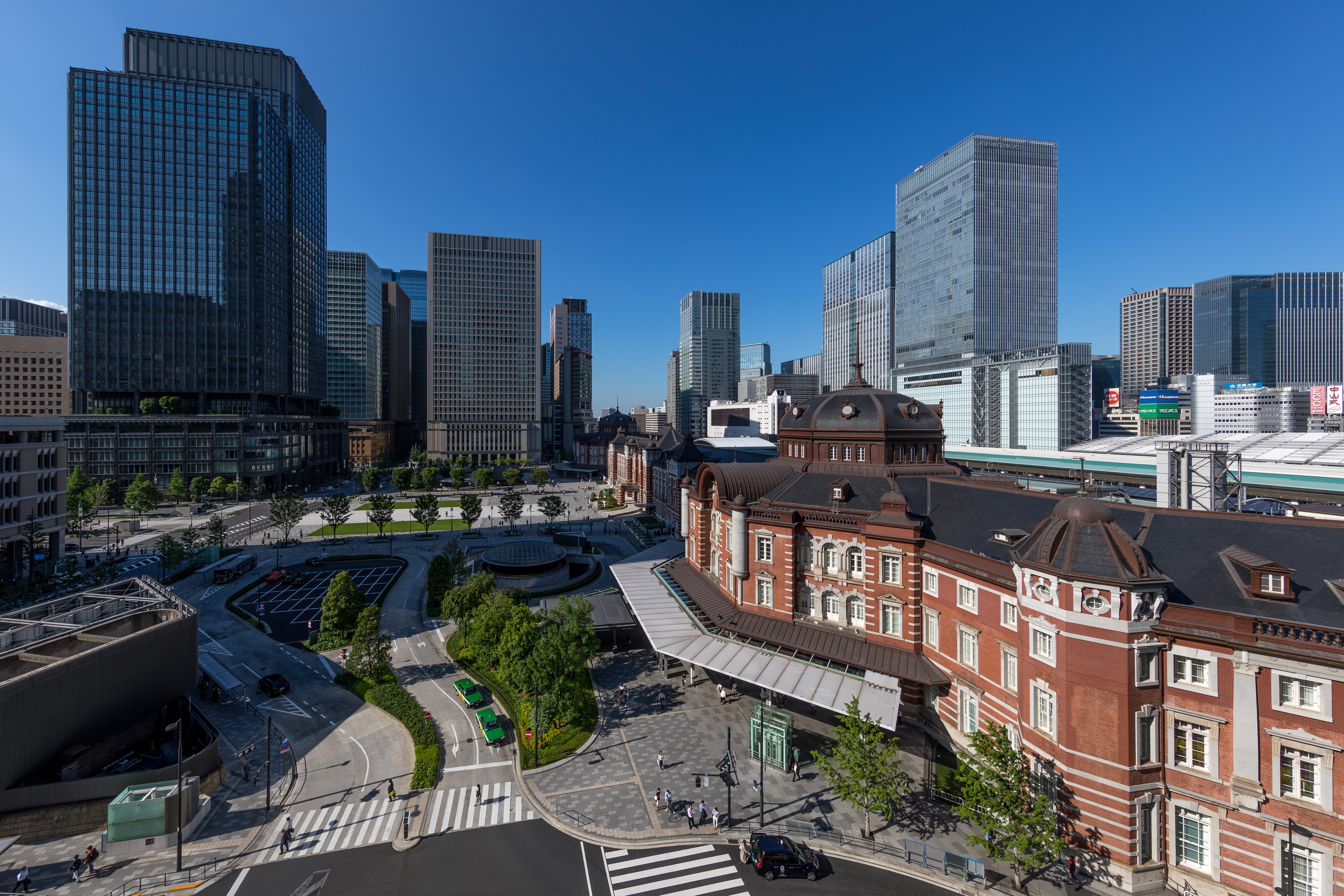
English: Marunouchi Central Plaza with Tokyo Station in red bricks and Shin-Marunouchi Building at the left, a sunny afternoon with blue sky, top panoramic view from the rooftop terrasse of the fifth floor of Japan Post Tower (JP Tower), located 2 Chome-7-2 Marunouchi, Marunouchi district, Chiyoda ward, Tokyo, Japan.
Français : Place centrale de Marunouchi (Marunouchi Central Plaza) avec la gare de Tokyo en briques rouges, et Shin-Marunouchi Building à gauche, un après-midi ensoleillé avec du ciel bleu, vue panoramique en hauteur depuis le toit terrasse du cinquième étage de la tour Japan Post (JP Tower), située 2 Chome-7-2 Marunouchi, dans le secteur de Marunouchi, arrondissement de Chiyoda, Tokyo, Japon. |
| Date | Taken on 13 June 2019, 13:55:23 |
| Source | Own work |
| Author | Basile Morin |
| Camera location | | View this and other nearby images on: OpenStreetMap |
|---|
Licensing
I, the copyright holder of this work, hereby publish it under the following license:
This file is licensed under the Creative Commons Attribution-Share Alike 4.0 International license.
- You are free:
- to share – to copy, distribute and transmit the work
- to remix – to adapt the work
- Under the following conditions:
- attribution – You must give appropriate credit, provide a link to the license, and indicate if changes were made. You may do so in any reasonable manner, but not in any way that suggests the licensor endorses you or your use.
- share alike – If you remix, transform, or build upon the material, you must distribute your contributions under the same or compatible license as the original.
This image has been assessed using the Quality image guidelines and is considered a Quality image.
|
File history
Click on a date/time to view the file as it appeared at that time.
| Date/Time | Thumbnail | Dimensions | User | Comment | |
|---|---|---|---|---|---|
| current | 04:03, 28 July 2020 | | 6,115 × 4,077 (10.57 MB) | wikimediacommons>Basile Morin | Uploaded own work with UploadWizard |
File usage
The following pages on the English Wikipedia link to this file (pages on other projects are not listed):