
File:Dingo-map.png
Size of this preview: 800 × 397 pixels. Other resolutions: 320 × 159 pixels | 640 × 318 pixels | 1,024 × 508 pixels | 1,280 × 635 pixels | 2,560 × 1,271 pixels | 4,500 × 2,234 pixels.
Original file (4,500 × 2,234 pixels, file size: 259 KB, MIME type: image/png)
Summary
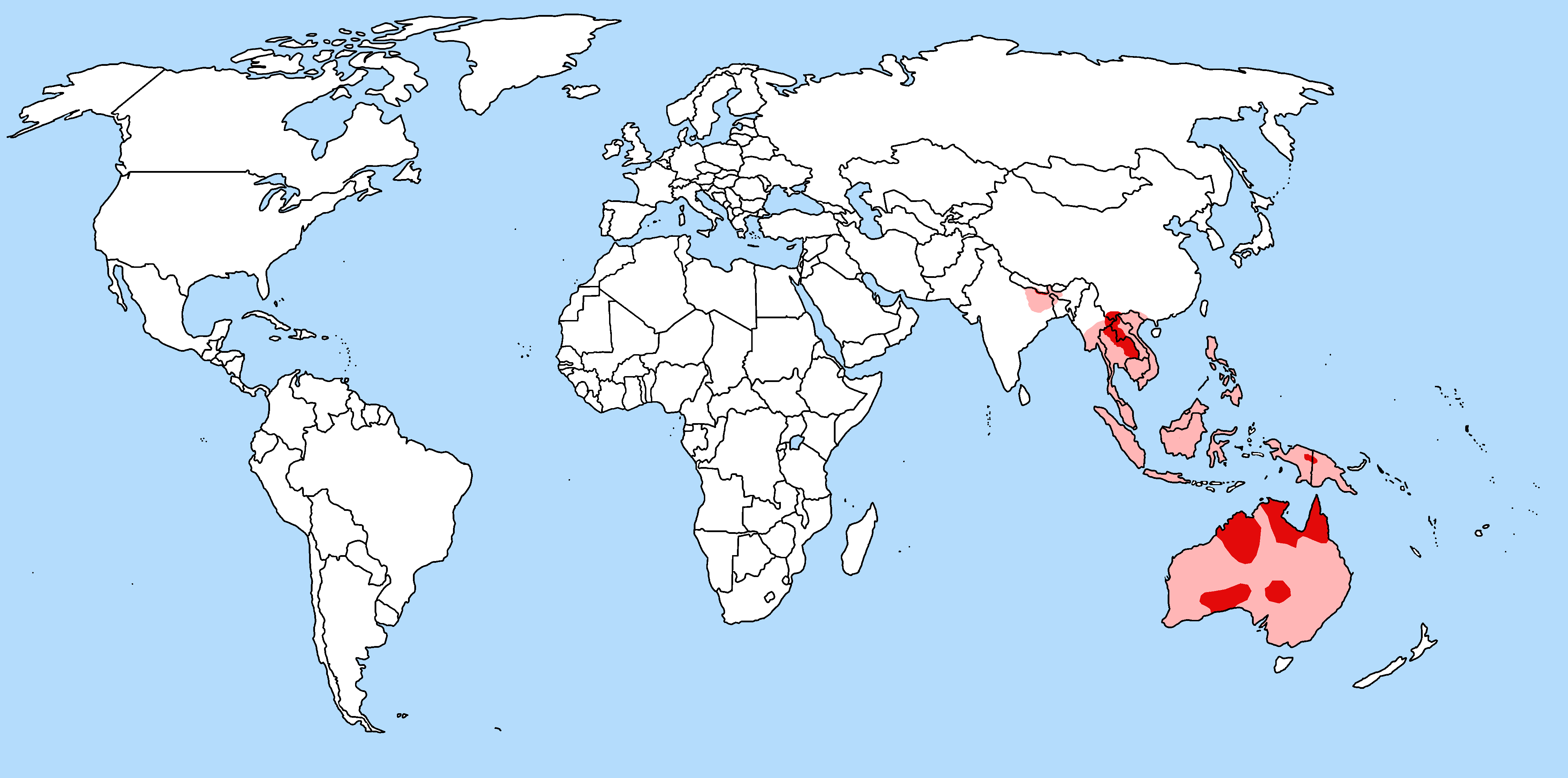
| Description | Geographic range of Canis lupus dingo with national borders added |
| Date | |
| Source | IUCN, Animal Diversity Web, and more |
| Author | TBjornstad 10:57, 15 July 2006 (UTC) |
| Permission (Reusing this file) |
Public Domain |
| Other versions | Image:Dingo-map-2.png |
The pinky colour indicate areas of crossbreeding uncertainty.
Licensing
| I, the copyright holder of this work, release this work into the public domain. This applies worldwide. In some countries this may not be legally possible; if so: I grant anyone the right to use this work for any purpose, without any conditions, unless such conditions are required by law. |
File history
Click on a date/time to view the file as it appeared at that time.
| Date/Time | Thumbnail | Dimensions | User | Comment | |
|---|---|---|---|---|---|
| current | 23:15, 25 March 2018 | | 4,500 × 2,234 (259 KB) | wikimediacommons>Maphobbyist | Montenegro and South Sudan borders |
File usage
The following pages on the English Wikipedia link to this file (pages on other projects are not listed):
Global file usage
The following other wikis use this file:
- Usage on simple.wikipedia.beta.wmflabs.org